Rainbow Mountain Hike: Elevation, Altitude, and Trail Guide
Nobody tells you about the smell of wild mint crushed under hiking boots at four in the morning, or how the cold bites your knuckles while you wait for sweet tea in a gravel parking lot. The rainbow mountain hike has turned into one of the most famous walks on the planet over the last decade, yet most people arrive completely unprepared for what breathing at 17,000 feet actually feels like. It is brutal, gorgeous, freezing, and strange.
Ten years ago, almost no outsiders came here. The striped mineral slopes of Vinicunca slept under seasonal snowpack until warmer climatic shifts exposed the layered sediment to the world. Now, hundreds of vans leave Cusco every single night, snaking through darkened Andean valleys toward Pitumarca and Cusipata. If you want to survive the climb and genuinely enjoy looking out over the Vilcanota mountain range, you need to understand the elevation profile, how to tackle the trail, and whether renting a horse is the smart move.
Book your rainbow mountain tour experience:
How High Is Rainbow Mountain Peru? Altitude and Elevation Realities
Let's talk numbers straight away. The summit viewpoint of Vinicunca sits at roughly 5,036 meters above sea level, which equals 16,522 feet. Some GPS watches read closer to 5,200 meters depending on which outcrop you scramble up for photos. To put that in perspective, this single viewpoint sits higher than Mont Blanc in the French Alps and only slightly lower than Everest Base Camp in Nepal.
You start walking from the modern parking area at Llacto, located around 4,630 meters. That means you are only climbing about 400 vertical meters on foot, but those 400 meters happen in atmospheric pressure that holds roughly half the oxygen found at sea level. Your lungs will burn after fifty paces. Walking on flat ground feels fine for a minute, then an invisible weight presses straight down on your collarbones.
Note: Do not book this hike for your first or second day in Peru. Spend at least two full nights sleeping in Cusco at 3,400 meters before setting foot near Vinicunca, or the altitude will punish you with nausea, migraine, and an early ride down in an emergency van.
When people ask how tall is the rainbow mountain or why rainbow mountain peru altitude hits so violently, the issue is not technical difficulty. The terrain itself is an easy, wide dirt track without rocks to scramble or cliffs to negotiate. The mountain air is just painfully thin. Even seasoned marathon runners find themselves stopping every twenty steps, gasping like fish on a riverbank while eighty-year-old local women glide past in wool skirts spinning yarn from drop spindles.
| Location Point | Elevation (Meters) | Elevation (Feet) | Oxygen Level vs Sea Level |
|---|---|---|---|
| Cusco City Base | 3,399 m | 11,152 ft | ~68% |
| Llacto Trailhead | 4,630 m | 15,190 ft | ~57% |
| Vinicunca Main Pass | 5,036 m | 16,522 ft | ~53% |
| Mont Blanc Summit (Reference) | 4,809 m | 15,777 ft | ~55% |
The Vinicunca Trail: What Hiking Rainbow Mountain Actually Feels Like
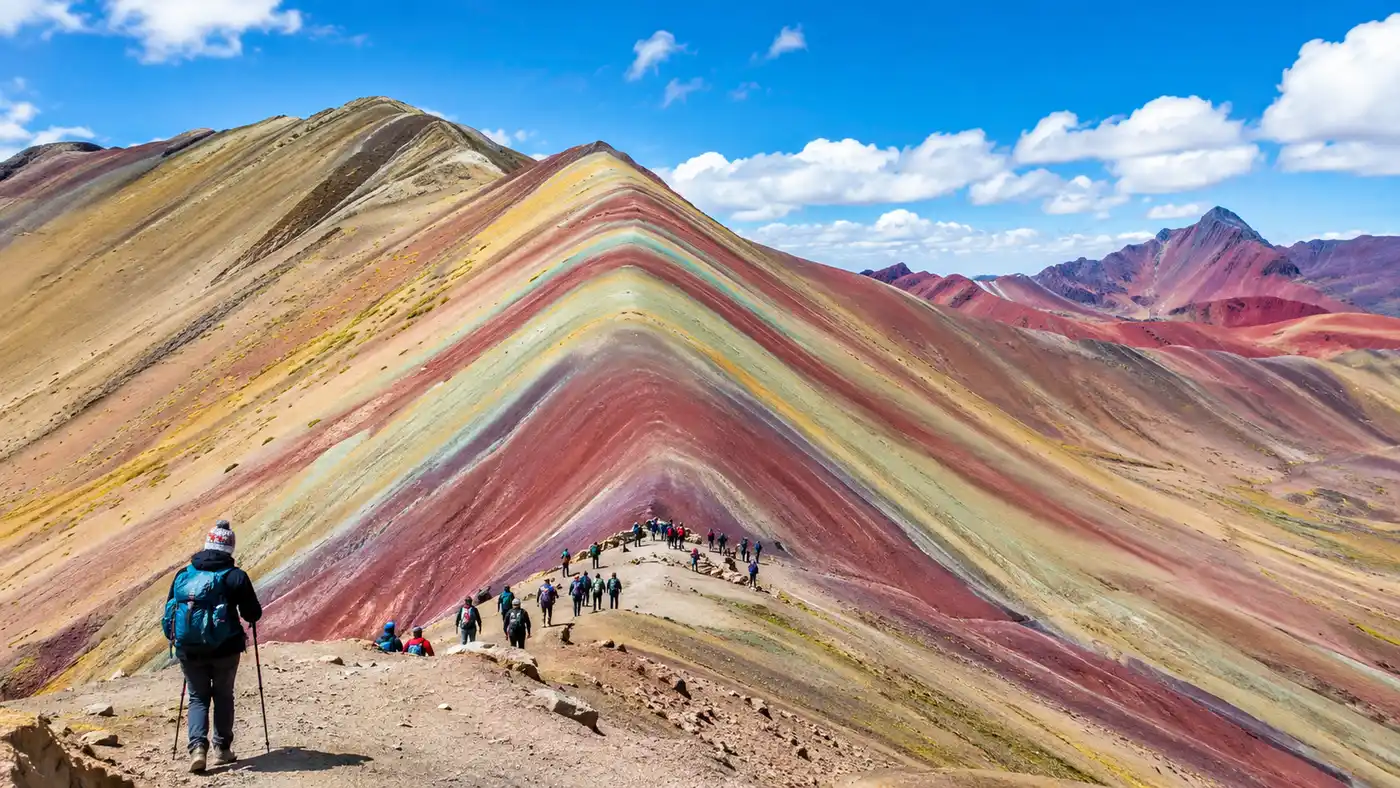
The standard rainbow mountain trail stretches roughly four kilometers each way. It begins on a broad, reddish gravel track through a high valley dotted with rustic stone corrals. Glaciers from Mount Ausangate hang like frozen white sheets over the ridgeline to your left, sharp and cold against the sky. During the initial hour, the incline remains gentle, rising steadily alongside a shallow stream where ice clings to the grassy edges until mid-morning.
Small groups of rainbow mountain peru llamas graze between the moss hummocks. Their owners sit on rocks wearing red ponchos, chewing coca leaves and watching the slow parade of tourist windbreakers drift up the canyon. The landscape feels stark. It has that wild, high-tundra beauty where trees cannot grow and wind scours every patch of bare dirt.
The last kilometer changes everything. The easy path terminates at the base of the final spine, turning into a steep switchback wall of dark mud and loose scree. This is where hiking rainbow mountain becomes a mental test. Wind whips over the ridge at 30 miles per hour, stinging your cheeks with dust or stray graupel snow. You climb five steps, pause to lean on your poles, take three deep belly breaths, and take five more. Nobody talks much on this section. Everyone is quietly bargaining with their calf muscles and lungs.
Once your boots clear the lip of the ridge, the panorama opens up abruptly. You see the famous striped face of Vinicunca directly ahead, while behind you the snowfields of Ausangate dominate the southern horizon. If you still have an ounce of energy left in your legs, take the narrow detour trail into the adjacent Red Valley Peru, where iron-rich crimson clay canyons offer an even more surreal landscape with barely a fraction of the crowds.
Rainbow Mountain Horse Tour Options and Practical Logistics
If the elevation sounds terrifying, you are not trapped. Local families from the surrounding indigenous communities run an organized horse cooperative along the entire valley floor. A rainbow mountain horse tour is not arranged as a full package in Cusco; instead, you hire a horse and an arriero (a local horse handler who leads the animal by a rope) right at the trailhead or along the first kilometer if you run out of steam.
The pricing is regulated by the local community syndicate. You will pay between 70 and 90 Peruvian soles for a one-way uphill ride, and maybe 60 soles if you also want them to walk you back down. The handlers walk alongside on foot, leading the horse at a steady, reliable pace while you sit in a basic leather saddle. It is a genuine godsend for travelers dealing with mild asthma or unexpected dizziness.
Pro tip: Horses cannot climb the final steep ridge to the 5,036-meter lookout due to safety regulations. You must dismount about 400 meters from the summit and walk the steepest, hardest portion on your own two feet.
Keep these points in mind if you plan on using a horse:
- Bring exact local cash: Handlers cannot make change for 100-sol bills and credit card readers do not exist up here.
- Rent early if you need it: On busy weekend mornings, all available horses are rented out within twenty minutes of the big bus arrivals.
- Hold the reins properly: The trail has loose stones, and while the horses are calm, sudden wind gusts can cause a stumble.
- Tipping is customary: Slipping your arriero an extra 10 to 20 soles shows respect for someone who just jogged four kilometers uphill at 16,000 feet while pulling you.
Most travelers sort out their transport through standard group day tours booked around Cusco's Plaza de Armas. If you want to understand departure times, bus routes, and self-drive considerations, take a look at our practical breakdown on how to get to Rainbow Mountain from Cusco before committing to an unvetted street vendor.
Book your rainbow mountain tour experience:
Why Is Rainbow Mountain Peru Colorful?
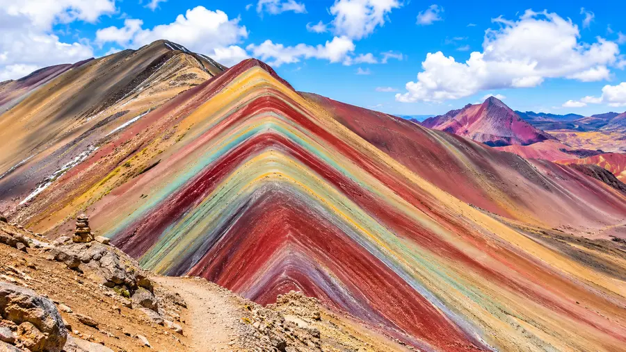
People often wonder why rainbow mountain peru colorful bands exist in the first place, or if the photographs are just wildly oversaturated internet trickery. The colors are very real, though bright sunshine makes them glow while heavy cloud cover makes them look muted and earthy. The mountain is an open-air textbook of weathering and marine sedimentary geology dating back millions of years.
Layers of sandstone, limestone, and clay were deposited in horizontal strata when this entire region was submerged beneath an ancient ocean and swamp basin. As the Nazca and South American tectonic plates collided, the earth buckled violently, thrusting horizontal sediment into dramatic diagonal folds. Over millennia, snowmelt, wind, and atmospheric oxygen oxidized the raw minerals embedded in each individual stratum, producing vivid chromatic variations:
- Red and pink shades: Red clay, argillites, and iron oxide mudstone mixed with weathered gravel.
- Green bands: Phyllites and sandstones rich in chlorite and copper-bearing minerals.
- Yellow and gold ribbons: Calcareous sandstones packed with iron sulfides and limonite.
- Bright white stripes: Pure quartz sandstone, limestone, and weathered gypsum deposits.
- Deep purple and lavender: Mixtures of claystone, manganese, and oxidized marls.
When the sun breaks through midday clouds, the mineral striations reflect light with shocking warmth. On rainy afternoons, water darkens the sandstone, transforming bright pinks into bruised maroon. It is rare to see bare planetary anatomy exposed with this level of clarity anywhere else on Earth.
Best Time to Visit Rainbow Mountain Peru and Acclimatization Tips
Weather up at 5,000 meters does not follow gentle rules. The southern Peruvian Andes experience two primary seasons: the dry season from May through September, and the wet season from November through March. April and October act as unpredictable transition months where you might get perfect sapphire skies or blinding afternoon hail.
The best time to visit rainbow mountain peru is generally June, July, or August. Days are crisp, skies are clear, and rain is rare. The trade-off is bitter cold. Morning temperatures at the trailhead frequently drop to -5°C (23°F), meaning frozen fingers and frost-crusted ground until the sun clears the canyon rim around 8:00 AM. During the wet season, the mountain can be completely hidden beneath six inches of fresh white snow, leaving travelers with views of an ordinary white peak instead of seven-colored strata.
Acclimatization requires patience and simple habits. Drink at least three liters of water the day before your trek, because dehydration accelerates altitude sickness rapidly. Sip coca tea or muña (Andean mint) with breakfast. Local pharmacies throughout Cusco sell Sorojchi pills, which contain an over-the-counter mix of aspirin and caffeine that helps dial back elevation headaches. Some doctors recommend acetazolamide (Diamox), but you need to start that prescription twenty-four hours before you leave Cusco.
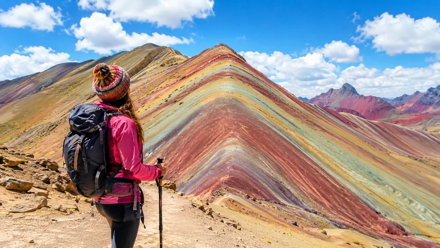
Wear layers that you can peel off quickly. You will freeze in the parking lot, sweat profusely during the uphill march, and freeze again the moment you stop walking at the windy ridge. A thermal base layer, a fleece pullover, a packable down jacket, and a wind-blocking shell will keep you comfortable across wild thirty-degree swings in perceived temperature.
Frequently Asked Questions about rainbow mountain hike
How difficult is the Rainbow Mountain hike for an average traveler?
The trail is non-technical and well-graded, but the extreme altitude makes it physically demanding. Anyone with average cardiovascular fitness can complete it by walking slowly and resting often.
Can you do the Rainbow Mountain hike without a tour guide?
Yes, you can hire a private taxi from Cusco to drive you to the Llacto checkpoint, pay the 25-sol community entry fee directly at the booth, and follow the trail independently.
Is Rainbow Mountain Peru hike dangerous?
The primary danger is acute mountain sickness (AMS). Falls are rare because the trail is wide, but hiking without proper acclimatization can trigger high-altitude pulmonary or cerebral edema.
Are there restrooms along the trail to Vinicunca?
Basic rustic squat toilets operated by local community members are spaced along the trail. They cost 1 to 2 soles to use, and you should bring your own toilet paper and hand sanitizer.
Quick Reference
- Trailhead elevation: 4,630 meters (15,190 feet)
- Summit viewpoint: 5,036 meters (16,522 feet)
- Round-trip distance: 8 kilometers (5 miles)
- Average hike time: 3 to 4 hours total
- Entrance fee: 25 soles per person
Book your rainbow mountain tour experience:
Is It Worth It?
Standing on the windswept ridge of Vinicunca with thin air scouring your lungs is an unforgettable experience, provided your expectations match the reality of high-altitude trekking. It is not a casual stroll, and the crowds between 9:00 AM and 11:00 AM can feel overwhelming. If you give your body three days to adapt in the Sacred Valley first, wake up before dawn to beat the commercial tour buses, and pack warm wool mittens, this wild ribbon of Andean rock will stay stamped behind your eyelids for the rest of your life.
Read more about rainbow mountain tour.